8/8/2024
by Felix Ban
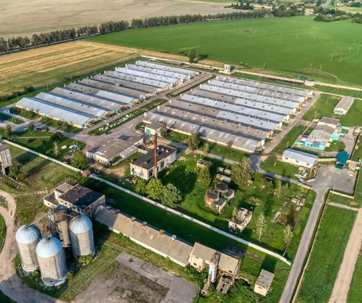
CAFOs (Concentrated Animal Feeding Operations) are industrial farms where a significant number of animals like cows, pigs, and chickens are kept and fed in extremely crowded conditions. These farms produce substantial amounts of waste, leading to various environmental concerns. This raises the question: where exactly are these facilities located, and what impact do they have on our environment?
The Challenge of Tracking CAFOs
The best way to find CAFOs is by tracking permitting data from the Environmental Protection Agency (EPA). CAFOs that meet specific waste production requirements must obtain a National Pollutant Discharge Elimination System (NPDES) permit from the EPA.
However, many CAFOs operate without these permits, making it difficult to determine their exact locations and sizes. Even if states disclosed all their permitting data, only about 30% of CAFOs have these permits, providing an incomplete picture of their environmental impact.
Defining “Megafarms”
Given the difficulties in locating CAFOs, we decided to use our own term: megafarms. The USDA conducts a Census of Agriculture every five years, providing extensive data on farms in the U.S., including information on farm locations, types of animals, and farm sizes. Although the USDA's farm size categories don't align perfectly with the EPA's CAFO definition, we at CIWF have defined 'megafarms' based on a combination of USDA data and EPA requirements. This approach allows us to utilize the comprehensive data available while still highlighting large-scale farming operations.
Why Knowing Megafarm Locations Matters
The U.S. relies heavily on megafarms for animal products, as current demand exceeds what can be sustainably and humanely produced. To cut costs, companies crowd as many animals as possible into small spaces, creating CAFOs.

These facilities place a significant strain on the environment and surrounding communities due to the immense waste they produce. This waste affects waterways, air quality, biodiversity, and environmental justice, leading to numerous ecological and social challenges.
Mapping Megafarms

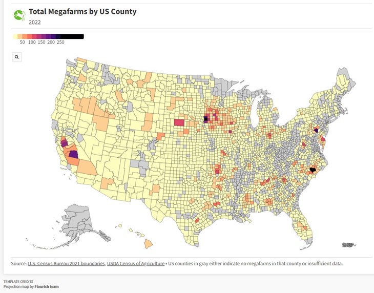
To monitor the environmental impact of these facilities, it's crucial to know where they are located. That's why CIWF created an interactive county-level map of megafarms in the U.S. This map reveals the concentration of these environmental strains and highlights areas of concern. Are there any in your county?
Regional Trends
Looking at the different species maps, certain trends emerge in how these farms are distributed. Dairy cow megafarms are predominantly located in California and Northern Wisconsin. Hog farms cluster in North Carolina and northern Iowa. Broiler chicken farms thrive in the Southeast, while laying hen farms are spread across the East, with a hotspot in Pennsylvania. Beef farms are the most widespread, with the majority of them spread across the West, with a major cluster in Cherry County, Nebraska.
Hog Farms and Nitrogen Pollution
Our findings are both fascinating and concerning. Megafarms often operate out of sight, hidden from public view. Some counties have over 100 such facilities, almost guaranteeing higher levels of environmental degradation for the people in and around these areas.

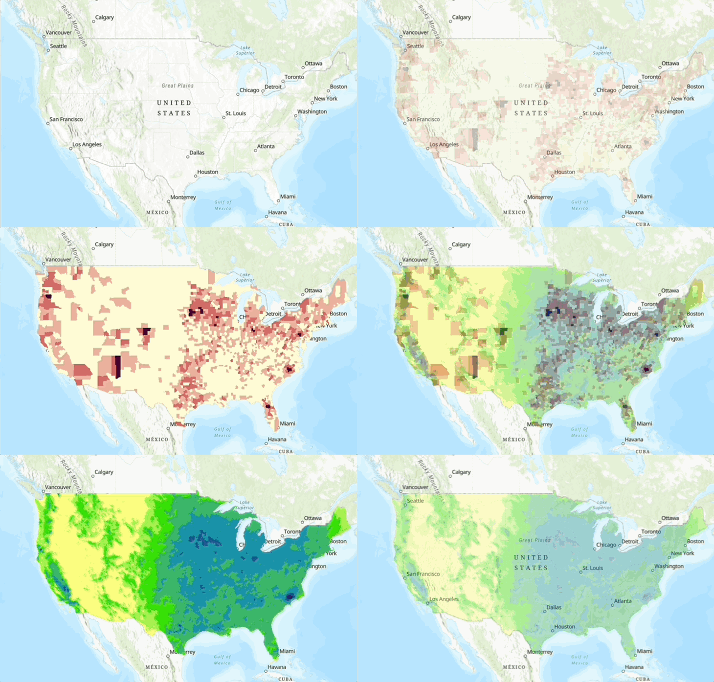
One striking discovery is the correlation between hog megafarms and nitrogen pollution. When we overlaid maps of hog megafarm operations and nitrogen pollution, we found they were nearly identical. This visual confirms what we already know; that the placement of hog farms is a major contributor to nitrogen pollution in these areas.
Take Action
Understanding where megafarms are located is the first step in addressing their environmental impact. Our map not only highlights the distribution of these facilities but also underscores the urgent need for better regulation and oversight. By shedding light on the connection between hog farms and nitrogen pollution, we aim to drive more informed discussions and actions to protect our environment and communities.
We invite you to explore our interactive map and see if there are any megafarms in your county. Additionally, check out our ca to join the movement for better regulation and environmental protection.

